Interactive lunar surface
A 3D Moon map made for exploring real places
Craterra presents the Moon as a continuous navigable landscape. The map combines global lunar elevation, surface imagery, named landmarks, and a coordinate system that lets every view point back to a specific place.
More than a rotating globe
A globe is useful for orientation, but it hides the experience of being close to the ground. Craterra lets you descend toward crater walls, cross maria, read latitude and longitude, and compare nearby terrain from a surface-level perspective.
The minimap and coordinate display remain connected to the same lunar projection used by the terrain. A location can therefore be shared as a compact Craterra link and reopened in the simulator rather than described only in prose.
- Reference radius
- 1,737.4 km
- Coordinate model
- Selenographic latitude and longitude
- Terrain source
- LOLA-derived global elevation
- Surface context
- LROC-derived lunar color imagery
Open a known landmark
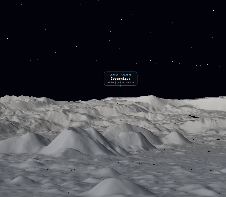
Use a real landmark as an entry point, then move outward and compare the surrounding terrain. Copernicus is the reference location used throughout the project for coordinate and terrain checks.
Copernicus
9.6° N, 20.1° W · 93 km. A prominent young crater with terraced walls, a central peak complex, and an immediately recognizable position on the near side.
Open in Craterra CRATERRA · 02Tycho
43.3° S, 11.2° W · 85 km. A bright southern crater whose ray system can be followed across a large part of the visible lunar surface.
Open in Craterra CRATERRA · 03Plato
51.6° N, 9.4° W · 101 km. An ancient, dark-floored crater beside Mare Imbrium, suited to a quieter northern location with a strong visual identity.
Open in Craterra CRATERRA · 04Aristarchus
23.7° N, 47.4° W · 40 km. One of the brightest formations on the Moon, set in a geologically varied plateau of rilles and volcanic features.
Open in CraterraFrom discovery to a personal location
The map is also the selection interface for Craterra digital plots. A plot is tied to the chosen surface geometry and its coordinates inside the service. Exploration comes first: the user sees the place before deciding whether it should become part of a personal record.
Desktop and mobile remain separate experiences so each can use controls suited to its device while sharing the same lunar geography and product model.